The Witch Creek Fire was the largest and scariest, though Stock Dog Ranch (where Daisy and I go to work sheep) was threatened more by the Poomacha Fire that was burning down Palomar Mountain, threatening the Palomar Observatory as well. Fortunately, between the weather and the help from aerial firefighters, the hazard seem to be dialing down.
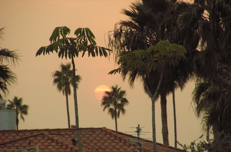
While we aren't in the line of fire, we get a lot of ash and horrible air quality. The moon was orange and the daylight sky was too. This picture was taken at sunset looking out from our front porch.
 Which was covered with a fine, choking ash.
 This enhanced satellite photo was taken on Wednesday. I added the little red X to show where we are -- in the plume of smoke from the Witch Creek Fire.
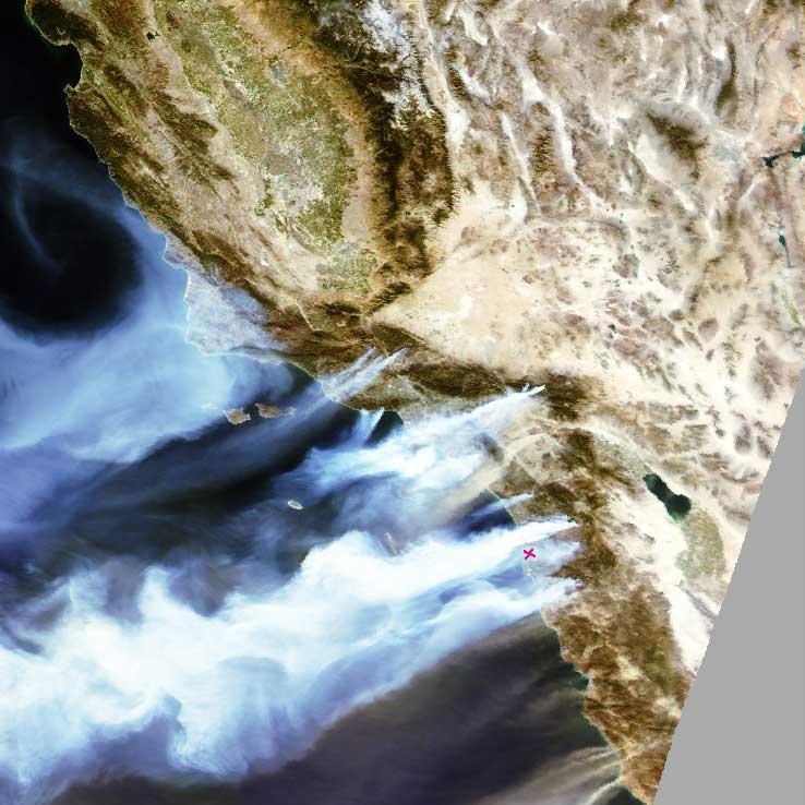 We're in our second day of offshore winds, and today we even had a little bit of rain, so our air is greatly improved!

No comments:
Post a Comment